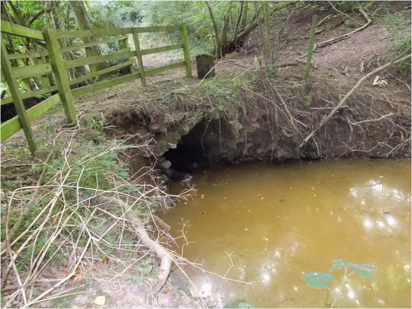
The Baveney Brook flows through large expanses of woodland and coppice such as Maxfields Coppice, Malpass Wood and Coachroad Coppice. It is a narrow valley, often steep sided: the name 'Breakneck Bank' to the east of Malpass Wood speaks for itself. For centuries (from at least the 16th century), although remote and sparsely settled, small pockets of industry grew up along the banks of the streams around here. Small
ironstone mines in Neen Savage (in Malpass Wood) are known from medieval documents and a thin band of coal also runs along the Baveney Brook on the boundary with Kinlet. The
Four Parishes Heritage Group has carried out research on the iron working industry in the area, and other aspects of local history.
Charcoal making has been a widespread industry in the Wyre Forest since medieval times, adding to the local distinctiveness of the forest. During centuries past smoky plumes from charcoal burning fires would have been seen rising up through the woodland all over the area. The activity leaves behind platforms as the charcoal residues pile up after each charcoal burning event, year after year. They can be seen all over the forest if you know what to look for, but knowledge about the distribution of these has grown as a result of a LiDAR survey of the forest through the
Grow With Wyre project which operated from 2008 to 2012. LiDAR is a Light detection and ranging remote sensing technique and can be applied to produce highly detailed three-dimensional surface models of the landscape. Charcoal burning hearths survive, at best, as low earthwork platforms or shallow, bowl-like depressions often under a thick layer of leaf litter. Being so ephemeral, charcoal hearths test the limit of LiDAR survey although they do have a distinctive LiDAR signature appearing as a small circular feature. Many possible examples have been recorded by LiDAR across Wyre. Volunteers have visited many of these and found that while some are spurious records a few are features related to charcoal production. Several could be seen along the banks of the Baveney Brook. You can look at these features on LiDAR mapping of your area of the Wyre Forest through our
Wyre Forest Lidar (Light detection and ranging) website.
There are also three substantial earthwork dams located along the Baveney Brook. These are clearly visible on the LiDAR imagery. They were breeched long ago, but originally would have controlled a large water resource associated with a Tudor blast furnace that was located close to the southernmost dam near Furnace Mill where the brook turns to flow east. The tranquility of the Baveney Brook today hides the great industrial landscape that once dominated its valley.
Our volunteers Terry Chandler and Jennie Stanton (volunteers for North Worcestershire Archaeology, or
Northwag) have been able to survey a stretch of the book starting at Wall Town Bridge to the northern boundary of the stream-walking project area.
 |
| Baveney Brook near Wall Town bridge |
Near Wall Town bridge, the bed of the brook is rocky underfoot. As is the case for many of the streams in the Wyre Forest, they are susceptible to bank collapse and repairs are sometimes needed. Here local sandstone blocks have been used to reinforce the banks.
 |
| Repairs to the banks of Baveney Brook |
 |
| Sandstone block repairs to Baveney Brook looking north |
 |
| General view of Baveney Brook looking south showing bedrock |
Terry noticed some unusual markings on some of the reinforcement blocks. Could these result from something dragging and scraping along the bank? Sometimes the towing of boats, such as canal boats, gauges lines into rocks or masonry along canals and rivers, but this seems unlikely here in the shallow waters of a small stream. The stones may even have been re-used from elsewhere, so might not relate to any specific activity on the brook at this point. Any suggestions as to what these might be and when they were put in place would be welcome.

Further north is a stone-built weir. Traditional structures like this weir, constructed in stone, are important to conserve as they blend into the landscape so well and add to the local distinctiveness of the area. They are much more preferable to modern concrete structures for this reason. Concrete has a high carbon footprint and eventually will succumb to wear and tear much more quickly than stone. Since the original post we have had an explanation of the stone markings, offered by Rollo Gillespie. See *update at end of post
 |
| Weir on the Baveney Brook near Wall Town bridge |
 |
| Weir on the Baveney Brook looking north |
Unusual finds can turn up during a survey like this. Although not of archaeological interest, these crayfish claws seen on the banks of the stream (probably a leftover from the meal of an otter or a stoat?) are of note.
We think these are claws of an American signal crayfish, an alien or non-native crayfish which is invasive in the streams of the area, causing damage to the native crayfish population. Our next blog post will about the invasion of the American crayfish in the streams of the Wyre Forest.
*Update on the stone markings mentioned above, provided by Rollo Gillespie, so thanks to Rollo for contacting us and letting us know that this is a geological feature - "
You are in the Wyre Forest coal area. This is the imprint of the bark of the Carboniferous forest giant Calamites which grew up to 30 or 40 metres tall. It has a diminutive living relative called Mares Tails -- Equisetum arvense.".
All photographs are courtesy of Terry Chandler.
By Liz Pearson
lpearson@worcestershire.gov.uk;
Google+


